1. Home
  2. Middle Ages
  3. The 1187 Campaign for Jerusalem
  4. Hattin

Battle

Hattin

4 July 1187

An army leaves the water, fights on the march, then comes apart between Maskana and the Horns.

Military history

How did lack of water, harassment, and loss of cohesion destroy the royal army at Hattin?

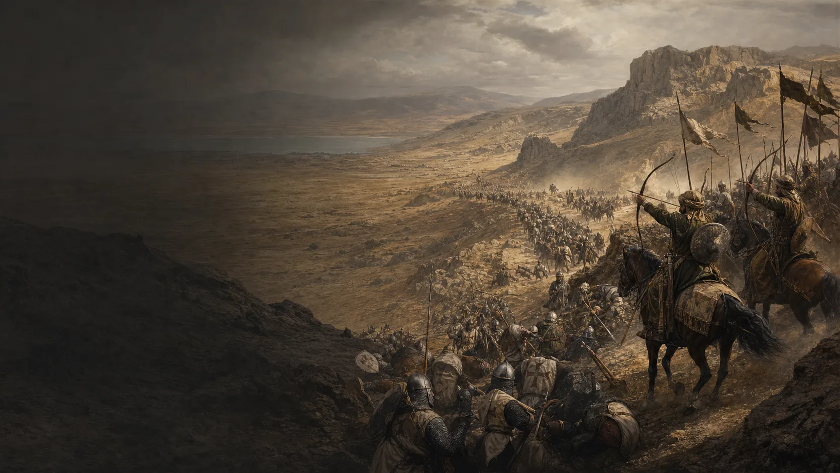
Hattin was neither a single charge nor the automatic unfolding of a perfect trap. On July 2 at Sephoria, Guy had to choose between keeping his army near water and marching to relieve Tiberias; the Latin account condemning that choice is partisan and retrospective. On the 3rd, the army left Sephoria in three corps—Raymond of Tripoli's vanguard, Guy's royal centre with the True Cross, and a rearguard formed by the military orders—then reached the Maskana sector under harassment. Access to water became uncertain; the column camped near a cistern whose water was at best insufficient. On the 4th, it resumed its march across the plateau. Attacks on the rear, arrows, heat, fire, and smoke gradually broke the connection between infantry and cavalry. Raymond escaped through the sector held by Taqi al-Din, but the traditions diverge: an ordered charge through opened ranks, or a cut-off vanguard making its escape. The main body continued to fight around the Horns before Guy and the True Cross were captured.

The march is already a battle

The fighting march rests on a concrete interdependence: infantry and missile troops keep the attackers at a distance while the knights advance at the foot soldiers' pace. The Latin account distinguishes vanguard, royal centre, and rearguard; when the cavalry accelerates or the rear is delayed, protection ceases to be continuous.

Maskana: crossroads, cistern, constrained choices

Kedar locates the Roman-road crossroads 1.8 kilometres northwest of Lubya, just south of Khirbat Maskana. Birkat Maskana may have retained some water, but not enough for an entire army: camping there therefore meant neither finding an abundant spring nor necessarily choosing a random desert. From there, several routes could lead towards Kafr Hattin, Arbel, or the lake; the sources disagree over the objective on July 4.

A victory that had to be built

Syntheses distinguish the divisions of Taqi al-Din, Saladin, and Gökböri, but our accounts reconstruct their intentions after the victory. The Ayyubids possess mobility, water carried to the camp at Lubya, and a supply of arrows; they must still maintain pressure, contain charges, and exploit Frankish ruptures. The map represents sectors of action, not a mechanical trap that closes by itself.

The council at Sephoria reaches us after the disaster

De Expugnatione first has Raymond advise remaining near the water, then attributes the departure to a night-time intervention by Gerard of Ridefort. This account provides access to the choices debated, but also to post-battle accusations. The reassessments by Morton and Ehrlich invite us to distinguish the disastrous outcome from a decision that was not yet doomed on July 2.

Military history

Sources

Indirect contemporary source, academic translationDe Expugnatione Terrae Sanctae per Saladinum: The Battle of Hattin, 1187

Passage commençant « In the year of the Lord’s incarnation 1187 » (§25–28) pour le rassemblement, les composantes et les nombres revendiqués ; « On Thursday, July 2 » puis « Toward evening on Thursday, July 2 » (§32–39) pour Tibériade et le conseil de Séphorie ; « On Friday, July 3 » puis « Three miles from the city » (§40–43) pour la marche en trois corps, Marescallia, la halte qualifiée de sèche par l’auteur, les flèches et les feux ; « When day had dawned » (§44–53) pour la rupture entre fantassins et cavaliers, l’arrière-garde, les échappées et les captures.

Near-contemporary Latin account in academic translation: the council dilemma, order of march, bivouac, fires, loss of cohesion, escapes, and captures. Its partisan attribution of responsibility and its numbers are not adopted as verdicts.

View ↗
Historical-topographical academic study, full textBenjamin Z. Kedar, The Battle of Hattin Revisited

The Horns of Hattin (1992), pp. 190–207. Dans l’édition HTML : paragraphes commençant « First, I gained knowledge » et « It follows that during the night » pour le carrefour romain, Maskana et la citerne ; « During the night » et « What was their objective? » pour le ravitaillement ayyoubide et la destination disputée ; « I believe it is impossible » à « arduous fighting continued » pour l’ordre incertain des épisodes, la sortie de Raymond, les murs des Cornes et les dernières charges.

Topographical and critical foundation: roads, insufficient water at Maskana, possible objectives on July 4, divergent traditions concerning Raymond and the infantry, function of the ancient walls, countercharges, and limits of overly precise animation.

View ↗
Indirect contemporary source, academic translationDe Expugnatione Terrae Sanctae per Saladinum: Capture of Jerusalem by Saladin, 1187

Introduction éditoriale pour l’occupation successive des villes et châteaux en juillet–août ; passages commençant « The city of Jerusalem was besieged on September 20 » et « On Friday, October 2 » pour le siège, l’accord proclamé le 2 octobre et la remise de la ville.

Immediate strategic consequence of Hattin: rapid exploitation against the kingdom's strongholds and capture of Jerusalem during the same campaign.

View ↗
Academic chapter, editorial summary and metadataMichael Ehrlich, The Battle of Hattin: A Chronicle of a Defeat Foretold?

Journal of Medieval Military History, chapitre 2, pp. 16–32 ; résumé Cambridge Core, lignes thématiques 1–3 et paragraphe commençant « The working hypothesis » : climat, divisions de commandement et supériorité numérique ont compté, sans qu’aucun facteur suffise seul ; l’analyse porte ensuite sur leur exploitation par les tactiques ayyoubides.

Safeguard against monocausal explanations and a scenario in which defeat was predetermined; relationship between Frankish constraints and Ayyubid actions.

View ↗
Academic monograph, chapter summaryNicholas Morton, Saladin and the Battle of Hattin

The Crusader States and their Neighbours: A Military History, 1099–1187 (Oxford University Press, 2020), chapitre 6, pp. 163–217 ; résumé du chapitre, phrases « The military abilities » à « reconsidered in the light of new evidence » pour la réévaluation de Guy et de ses décisions à Hattin.

Recent historiographical framework: do not infer Guy's incompetence from the outcome alone or turn accusations in the accounts into transparent facts.

View ↗
Institutional academic synthesisJoshua Prawer, Histoire du royaume latin de Jérusalem, trad. Gérard Nahon, tome I, chapitre IV : La bataille de Hattîn et l’année décisive

§16–18 pour le départ du 3 juillet, le Wâdî Rûmâna, Maskana, les deux routes, la perte de l’eau, la déviation vers Kafr-Hattîn et le camp entre Lûbiyâ et Kafr Maskana ; §19 pour le camp ayyoubide de Lûbiyâ et son ravitaillement ; §20 pour le plateau basaltique au pied du Nimrîn, l’attaque concentrée sur l’arrière-garde, l’arrêt, la chaleur, le vent, les incendies et la fumée ; §21 pour l’attaque de Raymond, Taqi al-Din, la fermeture du couloir, le groupe de Balian et le repli de l’infanterie.

Chronology and causal reconstruction of July 3–4, place names, water and terrain constraints, fire and smoke, and the mechanism of Raymond's breakthrough.

View ↗
Institutional cartographic sourceJoshua Prawer, Histoire du royaume latin de Jérusalem, trad. Gérard Nahon, carte XXIII : Bataille de Hattin

Carte XXIII, p. 652 du chapitre IV : routes autour de Maskana, Lûbiyâ, Nimrîn et les Cornes ; variantes vers Kafr-Hattîn, la vallée d’Arbel, le wadi Hamâm et les eaux près de Majdal. Le commentaire cartographique précise que les routes ne sont pas deux mouvements simultanés.

Check on topology and terrain markers; the formations' tactical positions are a separate schematic translation.

View ↗
Academic synthesis articleMatthew Bennett, The Crusaders’ ‘Fighting March’ Revisited

War in History 8/1 (2001), pp. 1–18 : pp. 1–3 pour la définition de la marche combattante et la coordination chevaliers–fantassins ; pp. 12–14 pour la formation, la vitesse imposée par les fantassins et la fragilité de la cohésion ; p. 18, n° 42 pour Kedar, les cartes de Hooper–Bennett et les trois « battles » de Hattin.

Tactical framework for the fighting march, distinction among infantry screen, cavalry, and maintenance of cohesion; not used to impose precise positions on Hattin's units.

View ↗
Staff-college monograph, work of military synthesisAhmed Aly, The Egyptian Way of War: A Tradition of Excellence Confronts the 21st Century

School of Advanced Military Studies, chapitre 2 : pp. 30–31 imprimées (PDF pp. 34–35), section « The Battle of Hattin, The Battle for Water and Morale » pour les trois divisions — Taqi à droite, Saladin au centre, Gökböri à gauche —, l’ordre de marche de Raymond/Guy/Balian, le ralentissement de l’arrière-garde, le camp et la sortie de Raymond ; cartes 8–11, PDF pp. 83–86, pour la marche, la nuit, la fin de matinée et l’après-midi du 4 juillet.

Control synthesis on the distribution of commands, Balian's place in the rearguard according to this reconstruction, the breakthrough sequence, and capture of the royal tent. Figures and retrospective intentions are not adopted as certainties.

View ↗
Later Muslim source based on earlier annalsFadl Allah al-Umari, récit musulman de Hattin dans Masalik al-absar

Extrait en ligne, paragraphes 7–9 : rencontre des deux armées, attaque de Raymond, Taqi al-Din qui ouvre ses rangs puis les referme, arrivée du comte à Tripoli, encerclement et liste des captifs. Le texte est une compilation du XIVe siècle fondée sur des auteurs antérieurs.

Independent check on the corridor opened and then closed by Taqi, Raymond's escape, and the final encirclement; the exact composition of the group that escaped is not extrapolated.

View ↗
Academic cartographic sourceBattle of Hattin: Map detail, The Land of Israel / Palestine Image Database

Notice institutionnelle de l’Image Database, description de la carte détaillée : plateau de bataille à l’ouest de Tiberias, Cornes de Hattin et extrémité nord-ouest du lac. Utilisée pour le contrôle d’orientation régionale. Un usage consacré à une attribution d’unité dépasse l’usage documentaire retenu ici.

Independent cartographic check on the relationship among the plateau, the Horns, and the Sea of Galilee.

View ↗

Edited by BattlesInMotion.com